St. Vrain Watershed Forests
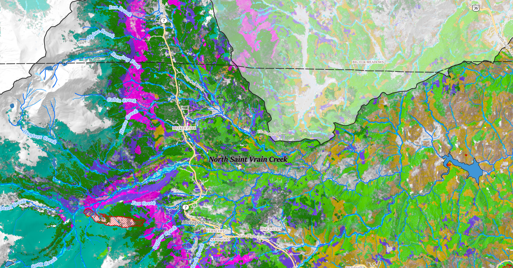
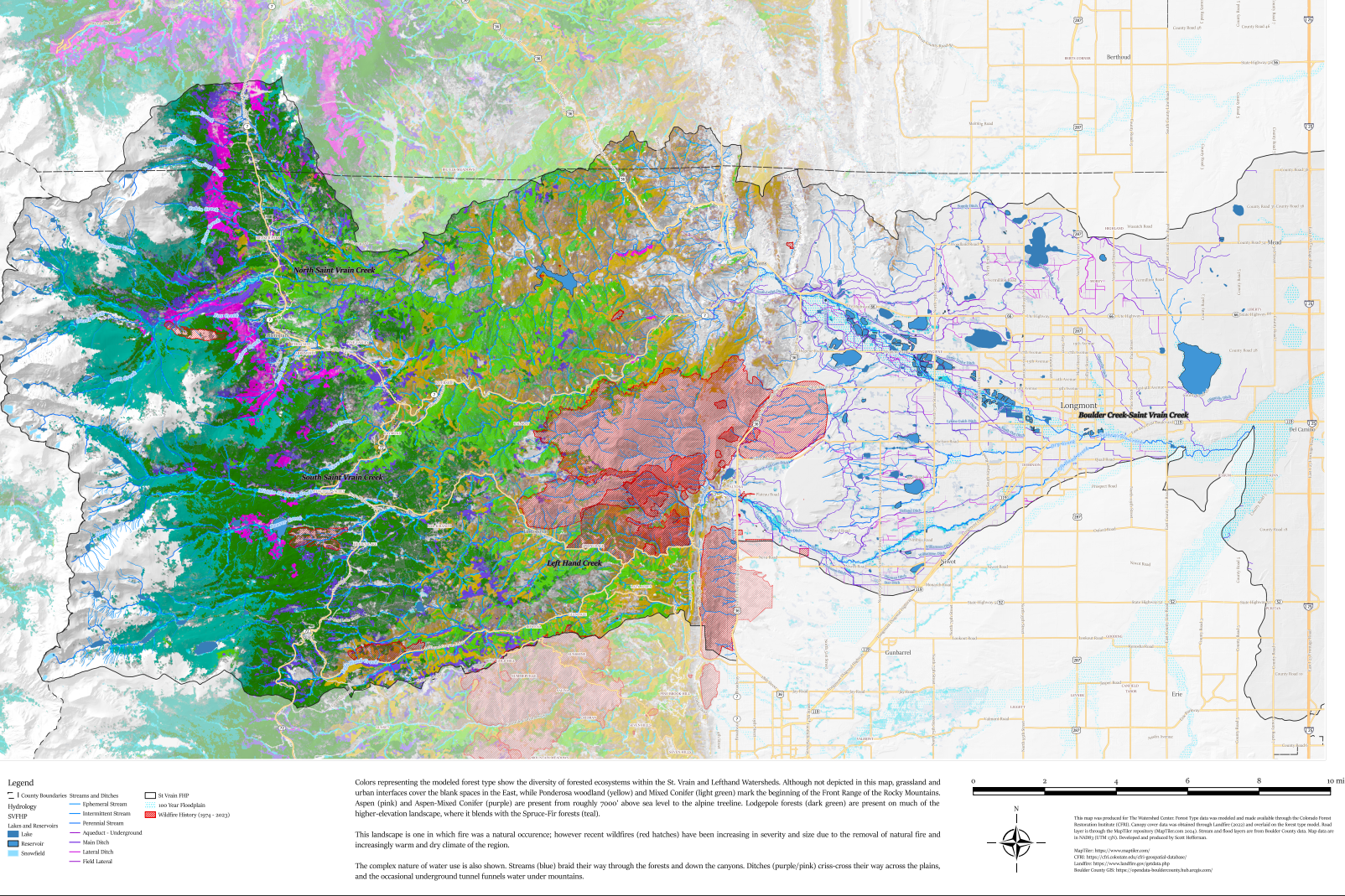
I work closely with The Watershed Center, who covers the St. Vrain Watershed, our northern neighbors. Since I already had the data for the Boulder Watershed Map, I just popped north and used the St. Vrain portions of the state-wide HUC-10 layer. Despite the short distance, there is a good bit of difference in our two watersheds, particularly in the upper elevations. The St. Vrain is much less dominated by lodgepole and has much more aspen cover.

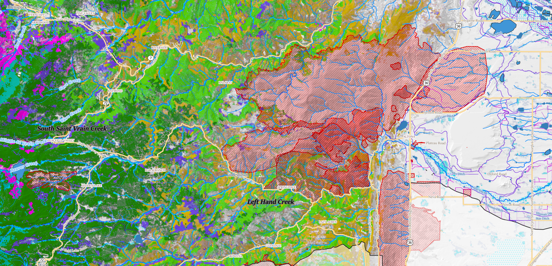
The presence of recent wildfires is also felt, even at the full scale of the watershed. Here's a closeup of the foothills where 3 fires have occured in the last 20 years.

Final Product

